Because it matters where you ride
Deciding where to cycle is one of the most important ingredients for a good time on the bike. In the past, for the ideal route, you needed a friend that knew the surrounding roads inside out, or you spent hours studying some map.
Today, it's a lot easier: two taps with your finger and we have a great starting point to refine the perfect route for your tour! And for that, it doesn't even matter if we want to make the daily commute to work a little nicer or if we want to spend several days bikepacking through the Alps.
So, in today's blog post, we'll introduce you to a few of the most helpful route-planning,. We will intentionally focus on open-source tools that offer the most customization and offer a way to actively contribute to the tools and underlying maps.
1. OpenStreetMap
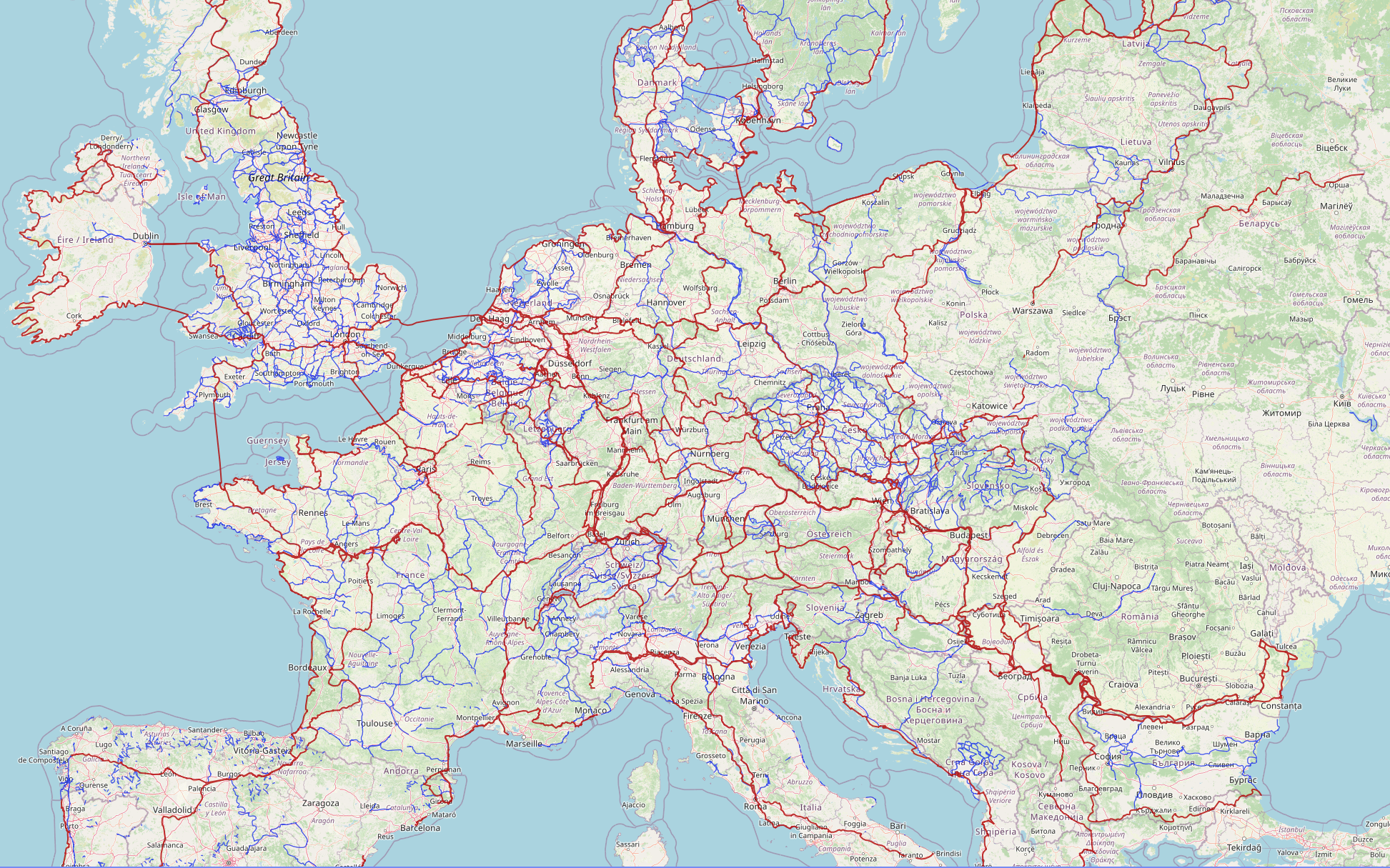
Most bike-specific routing solutions, which consider important criteria such as preference for elevation changes, road surfaces, or avoiding dangerous roads, are based on OpenStreetMap.
This platform offers a free, editable map of the world created by a global community of volunteers. Users can share, edit, and use all kinds of geographic data on OpenStreetMap, so you can find the very last trail, viewpoint, or hidden bike path.
"OpenStreetMap knows every spot off the beaten path, including bicycle parking and repair stations, which is particularly practical for cyclists. You can add it to the maps database if it is not there yet." - Anja Benson @buycycle
What is clear is that this sheer mass of data and detail could never in a lifetime be collected and continuously updated at this density by a single company. OpenStreetMap is therefore a true boon for route planning, from the community, for the community.
2. BRouter
Planning and riding a great route in general consists of two parts: the planning before and the navigation during your ride.
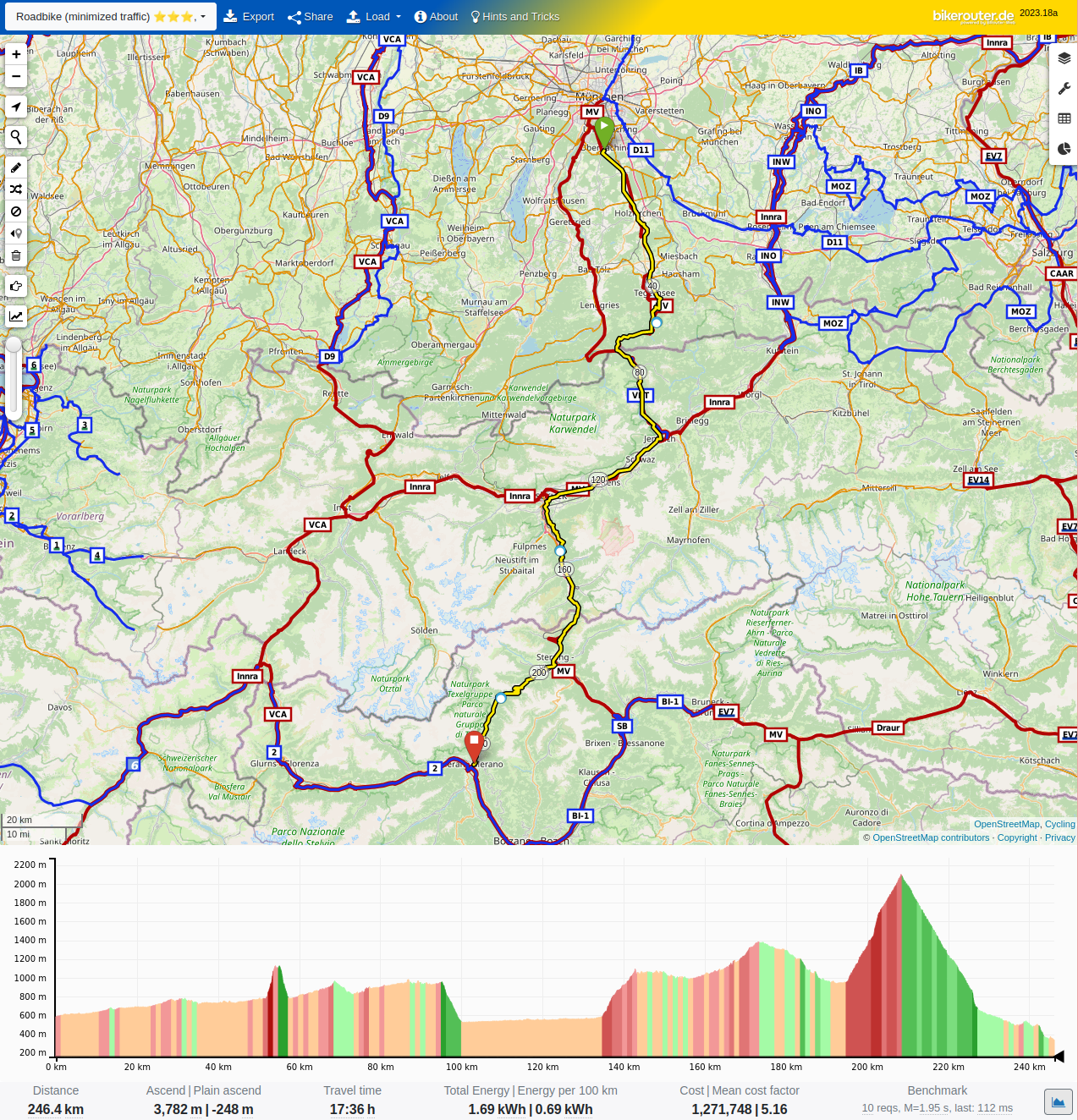
BRouter is another open-source project (based on OpenStreetMap) that covers the planning phase. And it works both in the app and on the web.
Here, you can find various maps in satellite or topographic view and cycling-specific overlays that give you access to entire libraries of bike trails (including those from waymarked trails and saved routes).
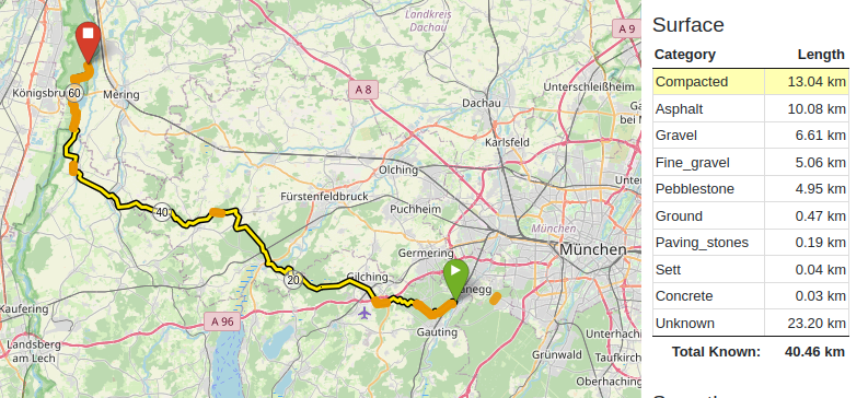
"Additionally, you will also find Gravel, mountain bike, or road bike routing profiles, which you can even customize to your individual needs in a second step. A great feature is the surface and road type view." - Alice Huot @buycycle
Here, you can see how much of your ride is the type you prefer. By clicking on them, they get highlighted live on the map, a great tool for refining the route. Once satisfied, you only need to save the map as a GPX file and download it on your navigation device.
In addition, and this is unfortunately still relatively rare among navigation software, your data is neither shared with third-party providers nor tracked or stored in any other way. You are also spared from in-app purchases or advertising.
All this makes BRouter a great tool for planning your next trip, although the rich interface might take some time and effort to get used to.
3. osmAnd
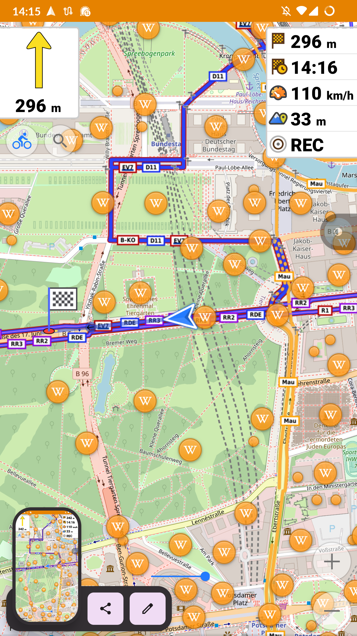
The GPX file from BRrouter can be imported into any navigation device.osmAnd is one of them and offers two crucial advantages: Bike-specific maps and turn-by-turn voice navigation. For you, this means: Stash your phone in your pocket or mount it on your handlebar and off you go.
The latter accesses your location while driving and informs you about surrounding national parks, statues, monuments, cities and... Well, about pretty much everything, that you cycle past that has a Wikipedia entry. That way, you challenge your body and educate yourself simultaneously!
The app is free but requires a purchase for a few plugins. Fortunately, this is unnecessary, as the free version already offers (almost) everything you need. Pro tip: The developers want to foster open source and give a free pro version when using the alternative app store F-Driod.
OpenStreetMap, BRouter, and osmAnd are all open-source projects. While their vast databases and open-source character make them great free, democratic tools that benefit us all, they can be a bit hard to navigate and use. So, if you're looking for something more user-experience-oriented, the following suggestions might be just right for you!
4. RideWithGPS
Another smartphone tool: This app which has been popular in the US since 2007, offers you different interactive maps. With it, you can create your own routes or discover predefined routes. Of course, based on distances, altitudes, road surfaces, difficulty levels or other criteria of your choice.
This is an extremely promising start and RideWithGPS continues in that style: You get turn-by-turn directions, voice guidance, detailed elevation profiles and offline maps, which makes the app a reliable tool.
"But only if you pay for the premium version. You have to invest about 10 Euros per month to access HeatMaps, voice guidance, and offline maps, in addition to regular route creation and saving." - Anja Benson @buycycle
Economically, this is a worse deal than BRouter or OpenStreetMap, but the app is also much more user-friendly.
5. Strava
We can't write an article about bike apps here without mentioning the KOM once. Strava is THE app for cyclists and you can also plan and save routes, access popular routes of other users using HeatMaps or track and analyze But that brings us to the crux of the matter:
"Navigating and planning with Strava is not wrong, but it is primarily about performance and competition. The app is, therefore, more of a social network than a good old-fashioned navigation aid." - Alice Huot @buycycle
So if you want a sense of community and a little sporty ambition, you're in the right place here. A segment to be conquered can also be route planning enough...
Cycling community
The fact that millions of routes are recorded in such detail and accuracy and are available to you for free on platforms like OpenStreetMap or BRouter is only possible thanks to the thousands of volunteers who contribute to these open-source maps.
So we can see that without the huge community of cyclists worldwide, our sport would not only be duller, but it would also be much more complicated to live and organize.
And so a small appeal to you: contribute to it! Register on OpenStreetMap and start saving features of your route, updating routes, OsmAnd, write a short ride report on RideWithGPS, or share your last route on Strava.
Final word
Or, sell your old bike on buycycle and make another cyclist happy! For questions about route planning or bicycles in general, our team, is always there for you. Also a look at the blog and one on buycycle.com.
Here, you can find not only the next owner of your old bike but also more than 15,000 used Gravel, Road and mountain bikes for your next adventure. In this sense, we wish you, as always, Happy browsing, happy navigating, and happy cycling.
Bikepacking
- What is bikepacking?
- What is a touring bike?
- What is a touring bike?
- What is bike touring?
- What is the best bicycle for long-distance touring?
- Bike touring gear essentials: our ultimate bike touring gear list
- How to choose a bike for bikepacking?
- How to plan the perfect route
- How to start bikepacking? Our beginner's guide to bikepacking
- How to train for bikepacking? Our best bikepacking training plans!
- How to train for bikepacking? Our best bikepacking training plans!
- Instagram's most famous bikepacking routes
- Instagram's most famous bikepacking routes
- The perfect tent for your successful bikepacking adventure
- The ultimate bikepacking gear list - What to bring on your next bikepacking adventure
- Top 5 best gravel bikes for bikepacking in 2024
- Where to sleep while bikepacking: how to choose the right shelter!
- How do I plan the perfect route for my bike tour?
Cycling the world
- By bike through Eastern Europe
- Copenhagenizing: Berlin Edition
- Europe by bike - part 1
- Europe by bike - part 2
- Balkan Voyage
- The most affordable cycling cities in the United States
- Discover the most beautiful US cycling rail trails
- Top 10 most popular cycling cities 2024 according to Google
- Most popular haunted trails in the U.S. according to Google
- Most romantic cycling cities for couples
- Cycling adventures along most picturesque vineyard paths in the U.S.
- How bike-friendly is Paris?
- Copenhagenizing: Paris
- Top US cycling destinations for 2024 by Sam Boardman
- The best destinations for thrill-seekers in the US
- Which US states are the most geared up for cycling?
- Discover the world's most affordable cycling cities
- Top 10 cycling cities in the U.S. for 2025 bucket list
- Top 10 Mountains in the U.S. for High-Elevation Cycling
- Best spanish winter cycling destinations